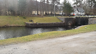
Fort Augustus to Aberchalder Bridge.
Distance 10 miles
Duration 2 hours cycle
Walk - 4 hours
This is an enjoyable 10 miles cycle, there and back along the towpath from Fort Augustus to Aberchalder Bridge. Start from bottom of Fort Augustus flight of locks and cycle along the road to the towpath at the top of the flight of locks. The towpath is wide and perfect for cycling, and the views are stunning. There is also a pleasant grassy path on the otherside of the canal (southside) which can be taken as part of a circular walking route. After a mile or so the opposite bank becomes quite rocky and 'natural' looking. The River Oich flows close by and you can see the forestry walk along the river bank. Follow the towpath for about 2 miles until you reach Kytra, a most picturesque and secluded lock. Another 3 miles on and you reach Collochy, and the Aberchalder swing bridge a short distance further on. Stop here and admire the Bridge of Oich.
It is possible to cross over at Cullochy Lock to avoid a weir between this point and the bridge.
This route could be divided up into shorter walking routes eg;
Fort Augustus to Kytra 5 miles return
Br.of Oich to Cullochy 1 mile?
Br. of Oich to Kytra.5 miles return
Parking is available at the Pay & Display carpark in Fort Augustus, or at the other end at the Bridge of Oich carpark by the swing bridge.
Points of interest
Fort Augustus - locks and buildings, Canal heritage centre
Kytra - built without inverted arch. Remote and isolated spot for lock keepers and families, who were allowed to keep cows & chickens and grow there own produce. Some steamer passengers used to disembark here and take the lovely tranquil walk to Fort Augustus (date?)
Weirs
Cullochy - workers house story- last of the original locks to be built - built like kytra without arch directly into rock.
Aberchalder swing bridge and Bridge of Oich
Wildlife - I spotted an eagle at cullochy!
Views - nevis range, river


